Sunday 30 June 2013

Scafell Pike

23 June 2013

Each year on the Summer Solstice many a walker, hiker and climber in the UK do the "Three Peaks". That's the highest peaks in Scotland, England and Wales and the goal is to climb them all within the same 24 hours as the longest day of the year.

Now, one would think that's either some short walking or lots of walking the dark. On the longest day of the year (daylight wise), at this latitude, there is almost 20 hours of daylight if you include twilight. When you consider a strong hiker can do each peak in about 4 hours, the challenge becomes one of transportation between the peaks.

The Three Peaks are: Ben Nevis in Scotland; Snowdon in Wales and Scafell Pike in England.

Of course, Scafell Pike is in my back yard at the moment...

No, this will not be a description of my attempt at the challenge, but that unfortunately the many hikers that day leave tons of trash up on Scafell Pike and somebody needs to pick it up. The hikers don't.

I volunteered to join a small group that annually hikes up Scafell Pike on the day after the Three Peaks challenge with the objective being to make the top and then pick up trash on the return down. It's an opportunity to not only climb another mountain (it's not a fell, or hill, but real mountain) but also to meet some interesting people and give something back for all the walking I do in some very beautiful country.

Unfortunately, the forecast was for windy, cold and rain. So I left my camera at home, but I did bring my cell phone (which does of course have a camera, albeit a poor one).

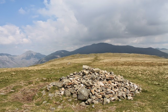
The climb was fairly straightforward. We headed up the quick route, from Wasdale Head Inn we walked east over to Lingmell Gill, the path being very well worn and the stones emplaced more like stair steps, than a path. About halfway up (550m or so) we took a break at Brown Tongue to rest, get a snack and let the group get back together (okay, so I could catch up...).

I took this picture looking west towards the Irish Sea. The cloud layer is just above us, but that promontory is Buckbarrow, the lake being Wastwater. A keen eye (zoom into the picture) would show you Gosforth. To the left, the next fell is Illgill Head.

This doesn't look like much, but basically it's a picture of the top of the mountain. Scafell Pike to the left and Scafell to the right, Mickledore is a saddleback between them...of course with the cloud you can't see anything!

And shortly after we ended our break and got back on the trail up, we went into the clouds and there was nothing so see but large rocks and occasionally grass (not much up there, really). The cloud got so thick we really couldn't see more than about 20 feet in front of us.

Ultimately, the slope flattened a bit and suddenly a wind break loomed out of the fog. Basically a large stone fixture with no roof, it's a great place to get out the wind. It was very windy, easily 30 mph steady with gusts higher. We loaded up on calories again and after about 15 minutes of rest opened our trash bags and started back down to pick up the trash.

Besides the fact that trash shouldn't be there, you'd be surprised the trash we do find...we actually found a dead octopus, about a foot long! Obviously a prank. Gin bottles (that's a lot of weight to carry up, besides the foolishness of liquor), clothes enough to outfit a hiker, even the shoes! Lots of wet tissues and plastic bottles and candy wrappers. I reached the bottom with a full trash bag, as did the other 8 folks in my group. The sampling says there must be a full ton of trash on the mountain, given how much 8 people brought down.

It took longer to get down than to climb up, just do to the slow going as we picked up trash.

Scafell Pike, the highest peak in England. 977 meters, 7.1 miles, 8 hours.

Until next time...


Thursday 27 June 2013

Hardknott via Border End

16 June 2013

Since my last walk was so successful as a two-fer, I (sort of) decided to try another. Actually, my objective was to take it easy, as the weather was supposed to be wet and a bit chilly, plus I wanted to find that Roman fort Suzanne and I missed during our drive through Hardknott Pass.

Hardknott is a fell overlooking the pass by the same name, it's south of me by two valleys -- I live in the valley with Wastwater, Eskdale is the next valley and Hardknott is the valley following Eskdale. With each set of fells I've walked, I've moved south. First Buckbarrow, then Whin Rigg, Boat How, now Hardknott. (By the way, "how" is Gaelic for hill, so I'm told...)


This time around, the fort was easy to find. The first time we missed it because from the west it's not obvious, but from the east you can see it as you approach. The first bit of walk is up a 30% grade road (the old Roman road) and my legs felt every percent! I had to park nearly 3/4 mile away, so it was a bit of a hike.


Once at the fort it is impressive. The remaining foundation/walls are still 6 feet 6 inches high. Originally much higher, the stones were used for other purposes. In the 1960's archeologists found a corner stone of sorts that was in-scripted with when and who built the fort - during Emperor Hadrian's reign (120 AD) and by the 6th Cohort of Dalmatians (modern day Croatians).

The foundations of the Commander's house and administration buildings are still there, as is the remains of the bath house. Behind the fort, and slightly below it are a series of small pits, with some stones around them...I think they may be latrines!

From the fort I headed up Border End, the fell overlooking the fort. East of Border End is Hardknott fell, connected by a short ridge-line.


Border End is steep, and the trail is not well marked, but I studied it a bit and it was obvious I need to stay left to get to the top...I should have remembered that later on!

The views were spectacular as I made my way up the fell side. This is looking north across the river Esk.


I walked up, sort of finding my way as there was no real trail like most fells. I reached a point where I though I would have to quit, because it got so steep! Way beyond my skills...


So I took a break, had a snack and some water and took a few pictures. This first one is looking west towards Ravenglass (the Roman port) and the Irish Sea. That's the Hardknott Roman fort in the foreground.


Here's a close up of the fort ruins. In the center is the administrative building, above is the Commander's house and below is storage. The ruin to the lower left, with the circle, is the bath house.


This view is looking north towards Whin Rigg (on left) and Illgill Head (on right).


While hard to tell, the dark craggy area at right center is Buckbarrow.


This is from Hardknott, looking over to the northeast at Scafell. Just to the right (in the cloud) is Scafell Pike, the highest peak in England.


This shot is the cairn on Hardknott, with the cairn of Border End in the distance to the left and Scafell to the right.


And of course it wouldn't be right to leave out the self picture...I didn't realize there was grass in front of the lens!


Hardknott 552 meters; 4 miles, 3.5 hours.

Until next time...


Wednesday 19 June 2013

Whin Rigg & Illgill Head

8 June 2013

With Suzanne back in the US I'm back to fell walking. The forecast was for sunshine and warm temperatures so I decided to try something just a bit more challenging. A two-fer!


Whin Rigg and Illgill Head both overlook Wastwater on its south side, with Whin Rigg to the west of Illgill Head and moorland connecting them. For the effort of climbing one I can easily walk to the other. While I could have walked to the trail head that would have added another 3 miles each way, and given the fell walk itself was supposed to be more than 7 miles, I didn't want to overdo it, especially if it were hot out. In the photo above I'm facing east so Illgill Head is left, and Whinn Rigg is in the center.

Initially the walk was very easy. The first mile is approaching the gill (steep gulley with a stream in it) and the trail just to its left. In this picture of Whin Rigg (on the left) the gill is the one with the trees in it in center and climbing to the right.


My path is left from here to go around the pasture.


It was an easy walk, a steady rise that was exercise, but not tiring. Hen I hit the gill.


It was a pretty steep hike up, not a climb but sometimes I thought it might be easier to be on my hands and knees! Of course, to add insult some guy came down at a run...really?


This is a view of Wastwater as I headed up.


At the top of Whin Rigg. That's Scafell off my left shoulder. Illgill Head is directly behind me.


The view back towards Whin Rigg from Illgill Head. Nothing special about the walk across the moorlands, other than it seemed every time I hit a rise, I'd see another to go before I got to Illgill Head. It was much farther away than it looked!


The cairn that marks the top. Obviously a very flat top...


This is NOT a way down! But that is looking across the valley towards Buckbarrow.


This little guy is the only color other than brown, green and gray up on the fells. The flower is about the size of your pinky finger nail.

7.7 miles, 480m (Whin Rigg) & 609m (Illgill Head), 4 hours

Until next time...


Thursday 13 June 2013

Edinburgh II

30 May 2013

Suzanne and I tried to go to Edinburgh again. We figured this time we would definitely take the train because the drive was just too long. Unfortunately, trains and Edinburgh just don't seem to work well for us.

We left the house early to catch the last train of the morning that would get us into Edinburgh early enough to see the castle, walk the mile, have lunch at our new favorite restaurant, do a bit of shopping and get us home before dark (so I didn't have to drive that hour plus on narrow roads in the dark). What I wasn't banking on was road work, slow vehicles, starting five minutes late and realizing too late how far away the parking lot was from the train station. At least Suzanne remembered to bring £10 in coins for the parking meter!

Just before we got to Carlisle I asked Suzanne if we go, or bag it and try the next day (ensuring we leave an extra 30 minutes early)? We decided to go for it, Suzanne's intuition tells her the train may be a few minutes late and I've learned to listen to that... We arrive at the lot with 2 minutes to departure, drop the coin in (after the ladies ahead of me fumble around asking for a coin here and a coin there from her friends--they look like they are going shopping in Carlisle as they ain't putting in enough to take the train!). Off we run to the station...

Yes! The train is late so we have a few minutes. We buy our tickets, Suzanne has to get her daily fix of the UK rag -- The Daily Mail. But as she steps up to pay a pensioner (think little old lady) pushes in front of Suzanne without even a "how do you do" and pays for her stuff, forcing us just that much bit more late! Will it ever end?! Eventually we find the train (the track numbers were not obvious) and just as we board we hear the chimes! Doors closing and it's time to find a seat. But first...we look at each other with apprehension...did we get on the right train? We moved so fast we didn't check...train is moving now...ah, the voice says this train is going to Edinburgh. Whew!

Which was the next odyssey. They were all marked "reserved". Our tickets were open seating (yes, cheap fares). After we walked around, and went to the next car we just took two seats together. No problem, right? At the next stop in Lockerbie an older woman gets on and in a very loud voice tells us we are in her seat! She was adamant, her ticket gave her the right to sit there! And in a thick Scottish brogue, to boot. (We really couldn't understand most of what she was saying, but we did understand "seat" "9" "mine" and "ticket". Being of above average intelligence most of the time we were able to string the words together into a coherent message. Okay, we'll move. Eventually we find ourselves standing as we cannot find seats and the porter is coming so we don't want to offend him, or not follow the rules. When he punches our tickets we ask where we should sit, he responds "anywhere". Not reserved? No, our tickets mean we sit anywhere so long as somebody can't show they have the seat. And...if all the seats are taken we have to stand. Sometimes it's standing room only!

Well, I'm not standing for two hours on a moving train...so we find two seats, as it happens near that loud lady, one of the empty seats being next to her. She offers to move so we can sit together. Well, she redeemed herself.

We get to Edinburgh and arrive right near the Royal Mile, which is near the castle. It's lunchtime so off we go to Porto & Fi, our new favorite restaurant. I had a quiche made with brie for the cheese, which was amazing. Suzanne had a risotto made with a fish stock and smoked fish. Good food and a pint and we're off to Edinburgh Castle.

But first we had to check out Grey Friars Bobby. Bobby was a faithful Skye Terrier back in the mid-1800's who never left his master's side, even after his master died. Bobby laid near his master's grave for over 14 years, leaving only to eat, and when he too passed he was buried near the graveyard (as a dog he could not be buried on sacred ground). His story is so legendary, Edinburgh raised a statue for him.


We headed up to Castle Edinburg, which was pretty cool...but I have to say that after touring Tower of London, Windsor Castle and Hampton Court; well let's just say it's not quite the same!


This is a view from the castle towards the Firth and out to the North Sea. That tower is where they drop the ball every day at 1pm when they fire the cannon to mark the time. That was done for ships in the harbor. We know why the Scots fire the gun at 1pm to mark the time right...well, it's cheaper than any other time of day as it only takes one shot of powder! Deep pockets and short arms.


They actually used this cannon until its breech broke in the 1800's, now they use a modern howitzer.

We finally had enough of Edinburgh so headed to the train station. We'd noted the schedule and got there about 15 minutes before the designated time...for the train to arrive in Carlisle. We'd misread the schedule! OMG when is the next train? Nealy an hour and a half, and it's during peak commuting time (our cheap fares were for off-peak travel only). We might be standing for the ride home, or worse they won't let us board...we figure we may be buying upgrades en route. If that's the case I'm getting a reserved seat so I can loudly proclaim I have one...

After lots of people watching we got on the train and luckily we found two empty seats, together. Smooth sailing, right? No chance! The toilets didn't work, one was so filthy nobody should be allowed in. Good thing we went just before departure...and didn't drink a lot leading up. Can we hold it? We must!

We arrived in Carlisle late, went straight to the toilets in the station...hungry for dinner but the snack shop was closed as it was so late. Straight home and by the time we got there we were ready to call it a day and get some sleep.


Until next time...

Saturday 1 June 2013

Holker Hall

31 May 2013

We picked up a flyer for the Garden Festival at Holker Hall while we were out earlier in the week. Suzanne had read about Holker Hall and wanted to tour the old home, which was built in the 16th century. The Garden Festival seemed a good way to spend the entire day as the Hall was about an hour's drive. And the weather was gorgeous.

We arrived and it was a nice festival of tents with local foods, wines, ales and goods. Plus there was an operating steam tractor on hand, sheep herding and rabbit hunting demonstrations. The latter used ferrets to "ferret out the rabbit" from its hole so the hunter could shoot the rabbit. Now we know the origins of that phrase.

We also talked with a nice gentleman about stone fences, the dry stone walls and the techniques used to make and mend them. Turns out the purpose of the fences was to parcel the land back in the 1600's when people could own the land but had to identify their specific plot. A stone fence was the most permanent means of saying "mine!"

Suzanne zeroed in on a foxhound sitting by one tent; we quickly walked over and started talking with members of the North Lonsdale Foxhounds, a pack of fell hounds that are followed on foot, not horses. It is because the land has so many to stone fences and hedge rows that following on horse is not practical. We have an invitation to come out to a meet during their season.

This place was terrier heaven! We saw all kinds - Patterdales, West Highlands, Jack Russells, Borders, Scottie's, Skyes, Wire Hair Foxes, Airedales, Schnauzers and Staffordshires. We have decided we want one of each! Well-behaved dogs are welcome everywhere here - outdoor events, trains and pubs.

We did tour the home and saw about a dozen rooms that were open to the public. We've decided while these places are nice to visit, we wouldn't want to live there.

Until next time...


Muncaster Castle

29 May 2013

Muncaster is an old(er) castle, built about 800 years ago on the foundations of another old Roman Fort here in Cumbria. It's been in the same family that entire time.

The tour includes the castle proper, the gardens and an owl sanctuary that is on the grounds. The castle was okay, and the owls pretty cool, but the show were the gardens.

The rhododendron were huge, big as trees!

And the azaleas were nearly the same size!

There is a person on the bridge in the lower left...

I'd never seen these before.

We spent most of the day there.

And what do these azaleas look like?

Primrose.

And another for scale. Everything was just HUGE!

Until next time...


Hardknott Pass

28 May 2013

After spending our Monday at indoor shopping venues (ok, groceries) Suzanne and I decided we would do the English thing and just head out into the wet day anyway on Tuesday.

As it turned out, the rain held off until late in the day, but otherwise it was overcast--I'll take it!

We ambled over to Ambleside, which is a town on the eastern side of the Lake District. From Gosforth we could either drive north or south around the mountains, or via Hardknott Pass due east. We chose the eastern route as it meant a pretty drive through the fells, past an old Roman fort.

We missed the fort, after we got home we looked online to see how we could have missed it, and realized where it was. No signs about, but there was a wide spot in the single lane fell road to "park" near the fort and walk up the fell to it, what appears to be about 100 yards or so. I did learn online that the road we were on was a Roman road, used to resupply the fort from the Ravenglass port just south of Gosforth. I'll go back and try again soon...

We did stop and see some English Bluebells. A very pretty, small flower shaped like a champaign flute.

They were all over the forest as we approached the open fell area.

The road was narrow, winding and a bit nerve wracking; I had to drive very slow the whole way. I didn't stop to take any more pictures, and by the time we got to Ambleside the rain had started, so I didn't want to damage my camera.

We had lunch at Lucy's, a place recommended to us and I have to second that. Very nice, we had a chocolate cake for a sweet after lunch there that was not sweet but very chocolatey.

For the drive home we chose the much quicker northern route, stopping by Grasmere for some gingerbread. Definitely very gingery. Not something I've had in the US at all. Was it good? Yes, but different.

Until next time...


Crabapple Tree

27 May 2013

Suzanne was able to see my Crabapple tree in full bloom. It peaked on the 27th so Suzanne and I took these pictures:

Until next time...