19 May 2013
The weather guesser got Saturday right: rain all day, sometimes heavy. So I did what any smart American would do...I went for a fell walk...on Sunday.
Earlier in the week I did my planning, looking for something different but challenging. The description of Eskdale Moor was of a pleasant hike up in the moors, a bit of scenery to look at and all in the shadow of Scafell Pike. At about 3 miles each way and only a little elevation, it sounded the trick.
Unlike Saturday, the weather guessers got Sunday wrong. The forecast was mostly sunny and warm, after a partly sunny start in the morning. So I decided my hike would start at 10 am and I'd enjoy the best parts of the day...not so with the weather.
Instead it was overcast, all day.
"Warm" may be in the 50's to some folks, but when I hear warm I think high 70's. So it was really a cool day and what warmed me was the hike.
Eskdale Moor rises in the middle of a valley southwest of Scafell Pike, and south of Whin Rigg. My place in Gosforth is in the valley north of Whin Rigg. I could have walked to the trail head, but at 3.5 miles it would have added a full 7 to an already long walk. I'm not ready for that...
The trail head is in Eskdale Green, a little village with more pubs than houses, it seems. It's a popular camping spot, and even has an elementary school.
The photo above is looking towards Scafell (can you see it in the distant fog?) from the school parking lot. Turns out the 1.5 miles I walked to the trail head I could have avoided, there's a parking area their as well.
In the above photo it's just out of frame to the left. This is a junction point, I can either take a boring hike across that bridge and then bear right, or make a hard right from where I'm standing and make an interesting hike up into the moors. Guess what I chose?
But first, a greeter met me at the first fell gate: a ewe with her lamb. It always makes smile how I seem to surprise them, like I popped out of nowhere.
So I turns right and pass through (actually stepped over) a logging trail gate and headed up the fell towards the moors.
The forest is real quiet as there aren't many bird noises and occasionally I could hear a cow mooing or a sheep bleating. But mostly just the crunch of my shoes on the gravel as I trudged up. There were a few flowers, but nothing that pulled me to take a picture. I did see this small brook that compelled me.
I emerged from the woods and was greeted by both a pretty and ghastly site. On one hand the valley was quite beautiful in the mist, but on the other was the scars left from farming the trees. A necessary evil...
From this point was the most difficult part of the hike. I had to leave the road and turn right to go up. Ten minutes of steep climbing up to the moors.
Once at the top the panorama is quite flat. I followed the trail off to my left until I found the first of the tarns (ponds). Okay, this looks more like a marsh, and basically that is what a tarn is, a marshy area that could also be a shallow pond.
Interestingly, it was so wet that the ground on the moors ranged from thick bog you could easily walk on to the marshy tarn above. My feet stayed dry but my pant legs were wet.
This is Blea Tarn, I skirted around its south edge, to the right there. Then up through that low pass on the right.
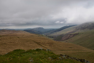
This was the view south after I passed over the ridge.
In the distance was my objective: Boat How. It's a rock outcrop that from this vantage looks like a Viking boat laid upside down. Off I trudged as it's a good 1-2 miles away!
As I walked I could hear a cascading water sound, but until I got this view off to my right (south) I wasn't sure where it was. It was quite loud, and that's got to be three miles or so to the opposite moor leading up to The Pike and Hesk Fell.
This the shot of the real treat: two sets of stone circles from ancient times. One on each side of that rock outcrop. They were each about 100 feet in diameter, the stones big enough to need a large truck to carry them. One theory is that it was a meeting place for tribal chiefs, each stone representing the area behind the chief that he controlled.
The view from Boat How. This is looking west towards the Irish Sea, that valley is the boring route up (and the route I took back). Hard to tell, but those trees in the center, to the left of the farm, are the ones I merged from and clambered up to the fell.
Finally, this is Burnmoor Tarn, looking east towards Scafell, which is that very high peak just behind it...don't see it? It's the one in the thick fog!
Here is one of my failed attempts at getting a self picture at the top.
Eskdale Moor to Boat How via two stone circles. 8.2 miles, 385 meter ascent, 4 hours.
Until next time...


No comments:
Post a Comment